Why is the Hoo Peninsula not treated as an equal part of Medway? Do you get the feeling we are being treated unfairly by our Local authority? Do Medway Councillors look across the water at the Hoo Peninsula and see it at as an industrial waste land ripe for development.?
Medway Council have just refused outline planning on the AC Goathams, Pump Lane development in Rainham after 1000s of objections to build 1250 houses.
Medway’s Labour Party said… “A very sensible decision, we need housing in Medway but it’s got to be the right housing in the right place and this proposal was not that” ….. We hope we can rely on the Labour Party for support when applications come forward for 12,000 houses on the wholly inappropriate Hoo Peninsula Medway’s most internationally protected asset.
MP Kelly Tolhurst said in response to a recent letter from a resident… “I have also been following the Council’s progress with their Local Plan closely, and have been disappointed that they have kept pushing the date when they will release the draft plan as this is integral to shaping our future in Medway. I know that the threat of development hangs over the Peninsula and at a time when we are without a Local Plan, it is important that we continue to come together as a community to fight proposals that will only damage the fabric and environment of our area and strain our local infrastructure and services. I fully agree with your concerns about the existing traffic congestion on the Peninsula and the difficulties this already causes to residents across the area, even without the addition of more homes.”
Medway Cabinet
In the meantime Medway Council’s Cabinet is keeping the people of the Hoo Peninsula totally in the dark about its HIF Bid. It is completely unacceptable that Medway Cabinet are pressing ahead with proposals for major transport infrastructure to serve 12,000 new homes on greenfield sites on the Hoo Peninsula without being willing to tell us :-
The environmental impact
The effect of traffic emissions, even though the Four Elms area is an air quality action area. The location and alignment of the new roads and roundabouts. Whether they considered the need for new development and infrastructure to be zero carbon by 2050.
Refusal to answer questions
They have refused to answer questions about what they are doing and say they will not tell us until after the deal with Homes England is signed and sealed. This is entirely contrary to the principles of democratic decision making. The Council’s plans, being cooked up without consultation, behind closed doors, in the town hall will cause immense damge to the rural character of the Hoo Peninsula. The Cabinet is keeping it secret from those most likely to be most affected by this massive and damaging project. We demand to see a masterplan for the project and it should be shown to the people of Hoo before the Council commits itself to this project.
Four specific questions for Medway Council
Why has the Council refused to answer the questions asked by HHPC about the Environmental Impact Assessment?
Why will you not answer questions of the HHPC about the location and alignment of the proposed new roads and roundabouts?
Why will you not answer questions of HHPC about emissions from the extra traffic to be generated by the massive new development?
Why has the Council refused to say whether they took account of the Paris Accord on reaching zero carbon by 2015 in making the HIF bid ?
As you will be aware as from Monday 15 June 2020 non-essential shops will be able to reopen. In order to prepare for this my Town Centres team have been working extremely hard on a plan to ensure that our high streets are ready.
To date we have undertaken business and consumers surveys, liaised with Kent Police and are working closely with colleagues across the Council to implement the following;
Communications Plan – Press release and social media Guidance Pack for Businesses – with links to a Toolkit Social distancing signage Social distancing stewards (for the first two weeks, then the need will be re-assessed)
Traffic, road and pedestrian high street management measures Cleansing programme
We are keen to engage local Ward Members in this work to ensure that the high streets open safely and would welcome your support in sharing this message with your local communities.
Medway Council the HIF Bid and Growth for Hoo and a refusal to engage Sounds like a soap opera episode doesn’t it? But this drama is been played out right now and right here on The Hoo Peninsula.
The HIF £170 million grant potentially makes Medway the biggest regeneration zone within the Thames Gateway. Once the deal is signed it will unlock a programme to build 10600 houses on the Hoo Peninsula. Not in the towns but here on our doorstep.
We have the right to know how it will affect us
Peninsula Ward Councillors, Parish Councillors and members of the public have been asking Medway Council a series of basic questions about the plans that will affect our health and way of life over the next 30 years. The response we have had so far has been completely inadequate, to be frank Medway is conducting an exercise of evasion and point blank refusal.
Instead Medway published a glossy brochure “Planning for Growth on the Hoo Peninsula”. A developers sales brochure using stock photos of developments around the UK. Very few real images of the Peninsula and certainly :–
No pictures of dozens of parked HGV’s and the human waste that seem to accompany them.
No pictures of the destruction of the golf course.
No mention of overrun hard working GP services.
No mention of our council run children’s services in special measures.
No details of the growing air pollution problems at Four Elms Hill.
No real information about housing numbers in the the areas .
No details of what real infrastructure will be provided at each stage.
My response to Medway Council
The Planning for Growth on the Hoo Peninsula Consultation 2020 – Medway Council Local Plan I most strongly object to the emerging Medway Council Local Plan and Medway Council’s current Development Strategy with regards to the development of a “Small Rural Town” around Hoo and Chattenden.
I note that Hoo Parish Council will be making a full response and representation to Medway Council when they publish their draft Neighbourhood Plan and will also be presenting a comprehensive report, including evidence and statistics to the Independent Examiner and the Secretary of State.
A very shiny and factually incorrect document has been produced. It’s a developers sales pitch and bears no resemblance to Hoo and the way developments have destroyed the area.
Most of the photographs are not of Hoo but rather they depict the “fairytale Medway” is trying to sell to the people of Hoo. This document lacks facts in every chapter and has no details of how many houses and where they will .
Residents have expressed time and time again that they have no wish for this level of development without a full assessment of the impact and a proper ‘Area Action Plan’ is produced to which they can have a real and meaningful input. Only by a full consultation with the people of the Hoo Peninsula and listening and acting upon that consultation will residents become partners in a scheme of this magnitude. We cannot achieve the vision set out in this fantasy consultative document.
It is obvious from recent developments that Medway Councils local plan is in fact a developers led plan and that commercial priorities will influence and control the large number of developments.
Protection of the Ecology that surrounds and encompasses the whole of our Peninsula is crucial to the health and well-being of the whole of the Medway, Kent and beyond. “Planning for growth on the Hoo Peninsula“ and the Local Plan does nothing to protect our ecology and makes no mention of the fundamental need to asses the impact of such a large number of homes..
The Local Plan must avoid harming the natural environment and protect the best of our heritage. The inclusion of the Hoo Peninsula into the Kent Downs AONB is a way forward of protecting and developing our natural and historical area with its ancient woodlands, grasslands intertidal habitats and marshes, all of which are of national and international importance. The Peninsula was not included in the Kent Downs ANOB in the late 1990’s although it is an obvious inclusion especially being a natural escarpment of the North Kent Downs.
Inclusion in AONB would not be a deterrent to development. It demands a better quality of build and the use of materials which are integral to the character of the area and is harmonious within the landscape. However, this of course should not be seen as a reason not to build “affordable housing”. In fact it could and should lead to a growth in community led rural housing. Much of this type housing should be ring fenced for people with a link to the Peninsula or work here. Providing this type of housing would enable young people and families to remain in close to home and this in turn benefits the whole community.
We need to encourage the vast numbers of empty homes in Medway back into the housing market. Have all of the many homes, flats and apartments above shops and maybe ex-military homes and government houses been identified and included into local housing needs?
Whilst Medway planners talk up cycling routes and public transport, we all know that for all new rural developments, the private car is the chosen form of travel being more reliable and for many the only option. This has a knock on effect for our air quality. Let’s not forget that during the construction of these houses, rail station and roads the concentrations of air pollutants will be exacerbated. No suggestions to reduce this impact has been made for the movement of construction materials during building and the thousands of tons of waste removed offsite by rail, road and water. How does the Local Plan mitigate for the the Carbon targets agreed in the Paris Accord?.
The rural town this plan talks about for Hoo creates many problems, the village has lost its banking facilities and what town can survive without banks. Our stand alone Post Office with sorting office used for the whole Peninsula has gone, along with our Police Station with no local police contact point. What town would you like to live in without a proper police presence. And of course this plan has not included any housing numbers for each of the neighbourhoods mentioned, making it very difficult for people to get a sense of the scale of destruction of our Peninsula.
School and school places must keep up with all these new developments and new communities as soon as they are planned and NOT after. These school places must be ring fenced for local children to prevent excessive travel.
The closure of Deangate Ridge Golf Club, a massive social and sporting area is at odds with improving sports, social facilities and well being. Why was it not recognised that Deangate Ridge should be a centre for sports, and well-being? A Peninsula sports and leisure centre is imperative. Deangate Ridge could become a Country Park that includes a swimming pool, indoor sports and fitness centre. This would go a long way to create health and social well being across the whole Peninsula.
Hoo Peninsula has a rich history of agriculture and fruit farming and these fields and orchards should be protected. Over the last few years these are falling to development and the Local Plan should protect such areas. The retention of high quality farm land is a priority, once concreted over they are lost forever. Large scale development without thought of the demand on fresh water supply, which we all know is a finite commodity, will make things worse. Are there any plans to protect surface and groundwater resources?What plans are there for the treatment of the obvious massive increase in waste water?
Air quality is a major concern. Monitoring of air quality seems very minimal and any increase in vehicle transport particularly HGVs will have exacerbate levels of nitrogen dioxide. What measures are in place to monitor ongoing air quality? Public transport on the Hoo Peninsula is abysmal and the inclusion of a rail service has been added as an afterthought. There is nothing to suggest a bus terminal at the proposed station therefore encouraging car movements across the Peninsula. This will not help air quality. Why is there no mention of utilising the rail link to take HGV traffic away from Kingsnorth by having goods transported by train? Why is there no thoughts on river usage around Kingsnorth? Would the remote rural areas of the Peninsula be better served by mini buses to and from a bus hub at the new station or Kingsnorth?
Healthcare is one of the major concerns to people of the Peninsula and it is important that provision is made for a healthy living centre or other supplementary healthcare facility. This will take away the constant need for travel to Medway Maritime which is becoming difficult for the elderly and disabled. This would of course take pressure off this very busy hospital. We cannot ignore the fact that the life expectancy for Medway residents is lower than the average for England.
Any encroachment of our villages beyond their present envelopes must be avoided as each and every village of the Peninsula has its own character and the green buffer zones between villages must be preserved and enhanced . It is with this that comes the problem of developers using the cheaper option of contributing to existing open spaces, rather than incorporating new open spaces within developments
Developers should be encouraged to use distinct character of the area and not just squeeze as many dwellings on a site as possible. People need to be comfortable with their new surroundings. The inclusion of communal space for all residents is essential The Coronavirus virus emergency has shown the need for local and domestically grown food, which help with supply and mental well-being. More allotments and larger gardens should be supported and advice given to developers to create these.
Four Elms Hill, the gateway to the Peninsula has been upgraded in the past but it has never kept place with development. The provision of a relief road, and new and upgraded roads is the latest promise. I and many residents are believe that these latest suggestions, which KCC have commented will be inadequate, will be insufficient for the residential development proposed and woefully inadequate if you add the vast amount of commercial development being undertaken and proposed at Kingsnorth.
Medway Council are vastly under estimating the investment in transport infrastructure required to sustain a development on the Peninsula on this scale.
Resident will never agree to 12,000 extra houses here and like me are incensed by Medway Council plans to that the to concrete over our unique Peninsula at all costs.
These plans for changing Hoo village into a rural town (whatever a rural town now is) are unsustainable.
My original thoughts on this has been widely supported by all Peninsula Parish Councils, Ward councillors Cllr. Filmer, Cllr. Pendergast , Medway Cllr Simon Curry and our MP Kelly Tolhurst (Parliamentary Under-Secretary of State at the Department for Transport).
RSPB, Kent Wildlife Trust and officers at Medway Council have also been very helpful and supportive. Of course, progress has taken a bit of backward step because of the Coronavirus emergency.
It has become evident after much discussion that an Area of Outstanding Natural Beauty [AONB] would be a better and more appropriate designation.
So what is the difference between an AONB and a National Park ? AONBs and National Parks are actually of equal importance for landscape and scenic beauty, the difference is that AONBs exist for the purpose of conserving and enhancing their natural beauty. National Parks, in addition to this, have a second purpose – To promote understanding and enjoyment of the area’s special qualities by the public. Because of this extra (and substantial) layer of responsibility they have their own independent National Park authorities with full planning powers running them.
AONB designation usually covers a wide area and many types and uses of land. Not all parts of an AONB are necessarily open to the public. In fact, most are not, as they are privately owned just like anywhere else. Towns and villages are sometimes included, and often small areas which are not at all beautiful get included too, with a secondary aim of meeting the need for quiet enjoyment of the countryside and having regard for the interests of those who live and work there.
We are continuing with the work behind the scenes and hope to bring you news as it develops. In the meantime please indicate your support be completing the survey if you haven’t done so already. [formidable id=1]
Thank you for the opportunity to address this Planning committee.
Deangate Ridge is a site of the highest sensitivity in the Medway area:
Its is Protected in the Local Plan as an Area of Local Landscape Importance and in an
area designated as Protected Open Space.
The site is also adjacent to the Chattenden Woods and Lodge Hill Site of Special Scientific Interest (SSSI).
It is registered as an Asset of Community Value which is not mentioned in the report as far as I can see.It is clearly a “valued landscape” in national policy terms, which should be “protected and enhanced”. I would ask you to refer toNational Planning Policy Frame workparagraph 170.
The Report does not deny that the development is directly contrary to the development plan and causes harm to amenity but claims that this is outweighed by public benefits of providing what is effectively a depot for Council service vehicles. The report tugs at our heart strings by referring to transport for special needs children an argument used, if I recall when this Council chose to close the site.
In fact the vehicles to be stored there are: 12 small vans, 11 flatbed vans, 12 tippers, 3 tractors, including trailer towing, 38 mini buses which may increase to 42 and 17 shipping containers, all to be kept at the site.
There is reference to an alternative sites assessment but no details are provided. The report says all the alternative sites were rejected for various reasons, including excessive costs.
Can I ask again for a copy of that “alternative sites assessment”?
If this action is just the Council saving money it cannot be a relevant consideration or justification for development that is directly contrary to both national and local policy.
There is also no reference to the shameful precedent that development of this site sets:
Norse – the occupier – unlawfully moves onto a rural leisure and public open space site in breach of planning control without planning permission; fells five mature trees and clears open green area; deposits 17 large shipping containers and brings some 76 diesel engine vehicles onto the site. Who gave them permission to do this – the Council?
It then applies for planning permission and offers, in mitigation, to paint the containers green when the weather improves and replant some trees on the site (not semi mature) .
Government policy is that this kind of behaviour is to be discouraged.
Further, it is conceded by the officers’ report that the development will add to the traffic movements all of which will go through the Four Elms Air Quality Management Area, which already exceeds legal standards.. The vehicles stored on the site are entirely diesel-engine buses vans and lorries and will go “exclusively” through the Four Elms Air Quality Management Area, mostly in the peak hour – when at its most polluted.
The Four Elms Air Quality Management Area was declared because it is transport related pollution and exceeded the maximum permissible levels of Nitrogen Dioxide. This development will add to the levels of pollutants already harmful to human health.
The Council is under a statutory duty to improve air quality in the Four Elms Air Quality Management Area in accordance with its own Air Quality Management Plan;
Medway now has the second worst air quality in the south east outside London.
An article in the national press describes official attitudes to this area, the Thames Estuary including the Hoo Peninsula as if it was some kind of “cultureless wasteland… as if it was a vast brownfield site for which any kind of development can only be counted as an improvement”.
The Report utterly fails to reflect the environmental sensitivity of the site and the mitigation offered is derisory. The development will further degrade the golf club, its landscape and blight its prospects of being brought back into public use.
Officers are recommending you grant planning permission with no guarantee that the temporary permission (to October 2021) will not be renewed or extended?
I would ask torefuse the permission or defer the decision pending the occupier providing a full, up to date Alternatives Site Assessment.
In liaison with the Deangate Community Partnership I have submitted further objection to the recent planning application for change of use of part of the Deangate site.
I hope these images and the knowledge that Medway Council ignore the fact that the entire Deangate site is registered as an Asset of Community Value inspire you to write and comment to : Planning.representations@medway.gov.uk and say that “Deangate should play a vital role in the Heath and Wellbeing of the residents of Medway and the Hoo Peninsula and not be used for commercial use”.
Proposal: Temporary change of use (until 31 October 2021) of first floor of clubhouse building to office use and temporary use of former golf course car park (until 31 October 2021) for parking of associated office workers cars; minibuses; grounds maintenance equipment / vehicles and storage of 17 Shipping containers.
Location: Deangate Golf Club Dux Court Road, Hoo St Werburgh, Rochester, Medway, ME3 8RZ
Application Type : Full Application.
The Deangate Community Partnership wishes to register its fundamental objection to this development.
It is stated in the Transport Statement that the development has taken place at the invitation of Medway Council.This is a retrospective application for development which has already taken place without planning permission and is therefore in breach of planning control and unlawful.
As such, it sets the worst possible precedent and example to other developers and to the communityby carrying out the development first and then seeking retrospective permission once the change of use has taken place.
In a written ministerial statement in December 2015, the then Housing Minister, Brandon Lewis, outlined the Government’s concerns about the harm caused by unauthorised development and announced a change to planning policy to make intentional unauthorised development a material consideration that would be weighed in the determination of planning applications (including retrospective applications) and appeals.The policy was put in place following concern about unauthorised development in the Green Belt, but applies equally to all unauthorised development, including this proposal.
The fact that the development has taken place with the encouragement of the Council which is also the local planning authority is wholly unacceptable action by a responsible public authority, and is directly contrary to the Government’s policy.
The development is not in accordance with relevant saved policies in theLocal Plan or the National PlanningPolicy Framework 2019.
The current statutory Local Plan is the 2003 Medway Local Plan. The site is within the countryside, lying well outside the settlement boundaries. It is a site to which relevant saved policies in the Local Plan would apply. Policy BNE 25 Development in the Countryside is one of the saved policies in the Local Planand has been extended by direction of the Secretary of State. It accords with the NPPF and should therefore be given full weight.
BNE 25 states:
“Development in the countryside will only be permitted if:
(i) it maintains, and wherever possible enhances, the character, amenity and functioning of the countryside, including the river environment of the Medway and Thames, it offers a realistic chance of access by a range of transport modes; and is either;
(ii) on a site allocated for that use; or
(iii) development essentially demanding a countryside location (such as agriculture, forestry, outdoor or informal recreation); or
(iv) a re-use or adaptation of an existing building that is, and would continue to be, in keeping with its surroundings in accordance with Policy BNE27; or
(v) a re-use or redevelopment of the existing built-up area of a redundant institutional complex or other developed land in lawful use; or
(vi) a rebuilding of, or modest extension or annex to, a dwelling; or
(vii) a public or institutional use for which the countryside location is justified and which does not result in volumes of traffic that would damage rural amenity.”
The proposal does not maintain and enhance the character, amenity and functioning of the countryside, Nor does the development fall within any of the categories (ii) to (vii) in BNE25 above and therefore is directly contrary to the principal countryside protection policy in the statutory development plan. There is therefore a statutory presumption in section 38(6) of the Planning and Compulsory Purchase Act 2004 against the development. The NPPF requires the Council, in determining applications to recognise the intrinsic natural beauty of the countryside.
The development is also directly contrary to the NPPF which seeks to protect existing open space, sports and recreational facilities.
The NPPF states“Existing open space, sports and recreational buildings and land, including playing fields, should not be built on unless: a) an assessment has been undertaken which has clearly shown the open space, buildings or land to be surplus to requirements; or b) the loss resulting from the proposed development would be replaced by equivalent or better provision in terms of quantity and quality in a suitable location; or c) the development is for alternative sports and recreational provision, the benefits of which clearly outweigh the loss of the current or former use.
Whilst the development does not involve new buildings as such, the 17 storage containers have a particularly unattractive industrial character and adverse visual impact and are damaging to the rural character and amenity of the area. The development leads to the use of the site for storage of heavy equipment which requires goods vehicles to transport it and which are often parked on the site.
Deangate is a vital part of Medway’s network of high quality open spaces and opportunities for sport and physical activity is important for the health and well-being of communities. The NPPF requires that applications for development of such sites should be based on robust and up-to-date assessments of the need for open space, sport and recreation facilities.
The application fails to support a strong environmental objective by contributing to protecting and enhancing our natural environment. Developing Deangate as described in the application fails to make effective use of land by help to improve biodiversity, use natural resources prudently, minimising waste and pollution or move us towards tackling climate change or a low carbon economy, contrary to the NPPF.
The application describes the Golf Course as “redundant”. This prejudges the question as to whether there is a viable future for the golf club. The use has not been abandoned nor could it be unless a permanent material change of use has been granted.
There is no recognition that the site is part of an Asset of Community Value, which is a material consideration as the site has a social objective in supporting the strong, vibrant and healthy communities of Medway and the Hoo peninsula.It provides an accessible service and open space that reflectsthe current and future needs of health, social and cultural well-being of residents.
The Transport Statement submitted with the application is inadequate as it appears to make no assessment of the effect of goods vehicles on the site which has poor access to the primary road network. It amounts to a short and limited traffic count which does not appear to distinguish the heavy vehicles using the site. Dux Court Road has an alignment that is notoriously narrow and twisting. There is a particularly narrow pinch-point between the site entrance and the roundabout onto Peninsula Way.
The Deangate Community Partnership urges the Council to refuse permission and to use its enforcement powers and take all necessary steps to require the use to cease as soon as possible.
Yours sincerely
For and on behalf of the Members of
The Deangate Community Partnership (unincorporated body)
The sun has set on 2019 as dawn breaks on a new decade, “The Twenties” a century ago it was dubbed the “Roaring Twenties”, a “Decade of Change”. A 100 years on what are our hopes and aspirations for the future ??
A greener, cleaner, brighter and more prosperous future for the Hoo Peninsula within the Greater Thames and Medway Estuaries, undoubtedly an area of outstanding natural raw beauty and deserving of recognition as a National treasure.
The Twenty Twenties must be a decade of inspiration, of conservation, and enhancement of this unique Peninsula with its heritage, Special Landscape and internationally recognised protection.
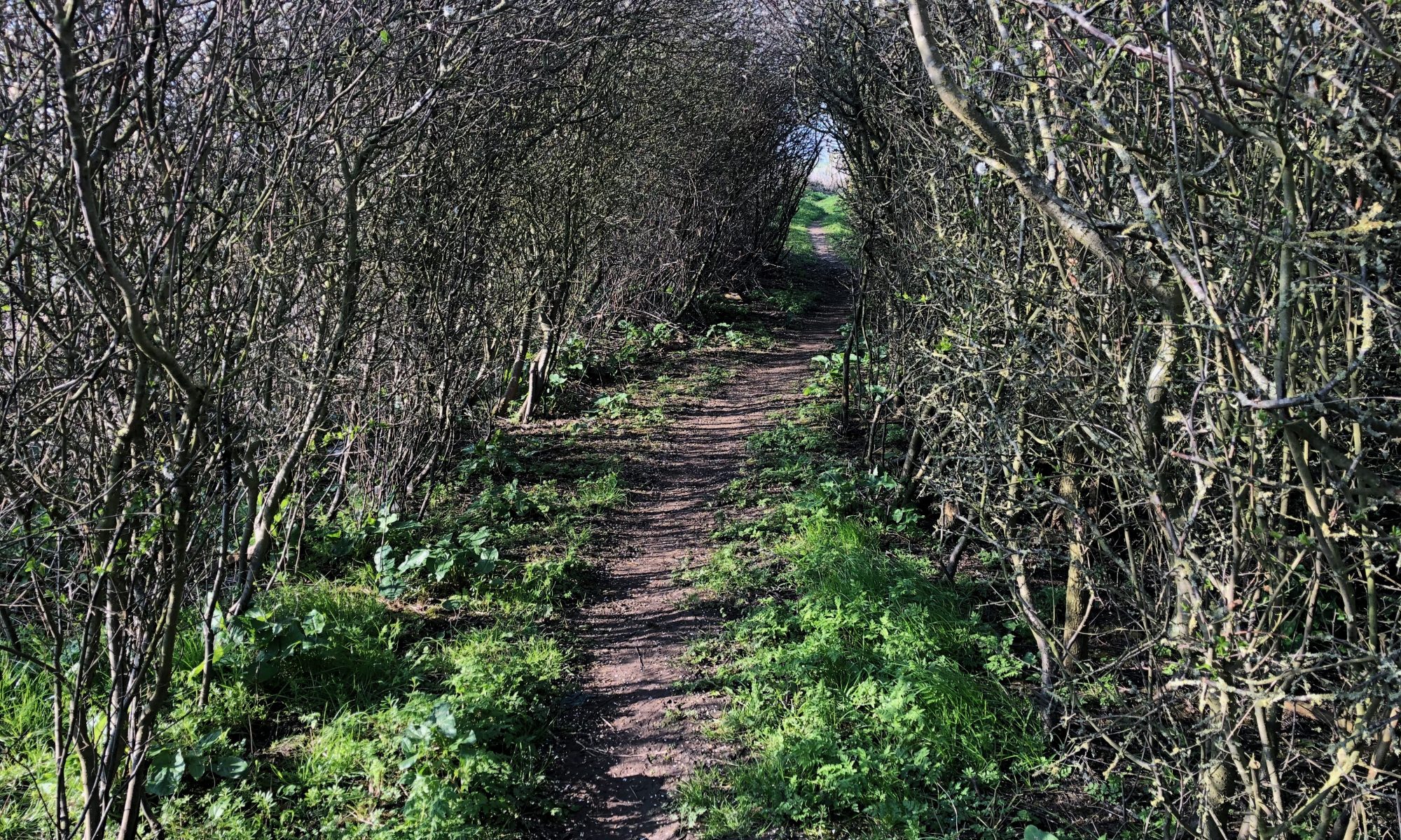
It must also meet the needs of those who live and work here or visit to explore and enjoy our ancient woodlands starkly beautiful marshland, stunning wildlife and rich estuarine habitat.
we welcome you to be part of this exciting plan, to share your expertise, enthusiasm and love of the countryside Be part of this historical move to safeguard the continued legacy of our unique Peninsula .
Please drop me a note at ron.sands@medway.gov.uk if you would like to help in any way.
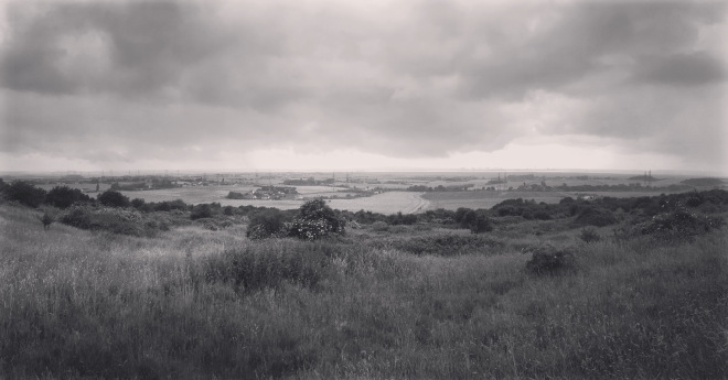
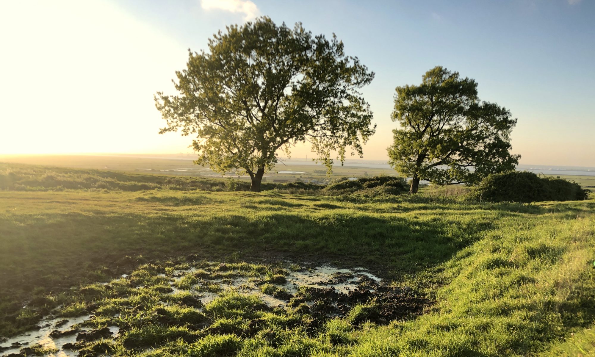
In 2013 Natural England described the Hoo Peninsula as a National Character Area(NCA) predominantly a remote and tranquil landscape of shallow creeks, drowned estuaries, lowlying islands, mudflats and broad tracts of tidal salt marsh and reclaimed grazing marsh that lies between the North Sea and the rising ground inland. It forms the eastern edge of the London Basin and encompasses the coastlines of South Essex and North Kent, along with a narrow strip of land following the path of the Thames into East London. Despite its close proximity to London, the NCA contains some of the least settled areas of the English coast, with few major settlements and medieval patterns of small villages and hamlets on higher ground and the marsh edges. This provides a stark contrast to the busy urban and industrial areas towards London where population density is high and development pressures are increasing. Sea defences protect large areas of reclaimed grazing marsh and its associated ancient fleet and ditch systems, and productive arable farmland. Historic military landmarks are characteristic features of the coastal landscape. Further information
Our Peninsula consisting of very productive A1 agricultural farmland renowned for cereal, root vegetables, soft fruit and traditional English orchards helped give rise to Kent’s much loved title “The Garden of England”. Add this to our extensive areas of ancient woodland, world renowned and internationally protected intertidal habitats, lowland wet grazing and a rich historic heritage and you begin to understand the reason all the Peninsula Parish Councils are calling on Medway Council to listen to the growing concerns for the future of our unique and distinctive area that we all know and love and to support our bid for National Park status.
We need Medway Council to acknowledge the importance and value of this landscape. To understand that the mosaic of wetland habitats that are the envy of the world can be the centre piece of a new National Park close to the city of London based here in Medway. A park that will give not only the people of Medway and Kent but the whole country the chance to experience The Hoo Peninsula along with our castles and historical Dockyard with its strong military heritage.
We need Medway Council to understand and promote this “sense of distinctiveness and uniqueness “ that encompasses the tranquility of the marshes with its nationally and internationally sites, with the agricultural and industrial sites working hand in hand where individual villages intertwine with historic sites.
This Peninsula, our Peninsula is ready to become a National Park, to secure environment for the future and safeguard our heritage and prove that our mix of urban and rural landscapes should and must be protected.
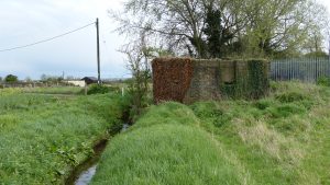
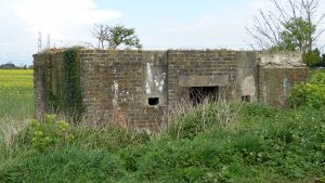
During the Second World War, the Hoo Peninsula was one of the most heavily fortified areas anywhere in England. Defensive ‘Stop Lines’ including pillboxes, barbed wire and anti-tank ditches cut a swathe across the whole landscape linking up the villages. The purpose of these defences was simple, they were part of Britain’s Outer London Defence Ring in response to the threat of German invasion. The intension was to delay and hold back enemy armoured columns that were expected to drive inland from the nearby invasion beaches and ports.
Today only fragments of this military landscape survive. Enough still remains to gain an impression of what was once was expected to be the front line against invasion.
The Hoo Stop Line; anti-invasion defence line stretched for approximately eight miles between the River Thames near Cliffe and the River Medway to the south-east of Hoo St Werburgh .
The War Office plan for the Stop Line shows a total of sixty infantry and eighteen anti-tank pillboxes. Each individual component would have been encircled in barbed wire for extra protection. There were probably other earthworks such as slit trenches.
The Hoo peninsula was a heavily militarised zone during the Second World War with Hoo itself designated as a defended village in 1941 with its own garrison. A further one hundred troops from the 347th Searchlight Battery, Royal Artillery were located at Kingshill Camp to the west of Bell Lane. High Halstow village to the north and the Royal Navy Ammunition Dump at Lodge Hill were also garrisoned.
The stop line was intended to provide a man-made defence against invasion.
Development of the Peninsula must be sympathetic to the Hoo Stop Line and its historic structures and continue the excellent work already undertaken at Allhallows on the historic Slough Fort
This is another example of how important the cultural heritage of the Peninsula is and shows why it should celebrated in a National Park.
Please show your support and agree with me by completing this simple survey.
The Hoo Peninsula is part of and the central focus of the Wider North Kent Marshes which stretch from Dartford in the west to Whitstable in the east. This area is internationally renowned and protected for its wetlands and nationally protected by sites of special Scientific interests. However the Development in Hoo and its out lying villages is not the only threat this important and most precious place faces.
The new Lower Thames Crossing which will cut right across an area of wetlands near Higham and will inevitably increase the pressure on the need for new housing and business to support the ever increasing population.
The more I learn the more I feel I need to stand up for this special an unique place.
So what do we mean when we say a new National Park? Clearly we do not live in an area you would normally associate with the status of “National Park” we are not in the “Lake District” or “The New Forest” why would we ever consider making the Hoo peninsula a National Park?
Consider for a moment, London, which has just become the first “National Park City, “London will be: a city which is greener in the long-term than it is today and where people and nature are better connected. a city which protects the core network of parks and green spaces and where buildings and public spaces aren’t defined only by stone, brick, concrete, glass and steel”.
The Hoo peninsula and its Greater North Kent Marshes is in a unique position between the City and Sea, it could and should be a landscape asset maintained as a legacy for all our futures a place of unique biodiversity sensitively accessible to everyone.
Planned to achieve an environmental balance to the city and able contribute to the carbon neutralisation of the growing urban sprawl an area to create wealth and employment in tourism and leisure and local produce.
Rural regeneration of a landscape designed to showcase this unique area between the Thames and Medway estuaries featuring it’s raw beauty as Dickens described a landscape rich in history.
Massive schemes for road bridges, unco ntrollable and unsustainable development, fill me with fear and dread that we are on the cusp of losing what we have forever. Join me in the fight for the future.
In 1861 Charles Dickens ‘ famous novel Great Expectations was published and I’m sure many of you will recollect his famous words written about our marshes that are as relevant now as they were nearly 160 years ago .
“Ours was the marsh country, down by the river, within, as the rivers wound, twenty miles of the sea. My first most vivid and broad impression of the identity of things seems to me to have been gained on a memorable raw afternoon towards evening. At such a time I found out for certain that this bleak place overgrown with nettles was the churchyard………. and that the flat dark wilderness beyond the churchyard, intersected with dikes and mounds and gates, with scattered cattle feeding on it, was the marshes; and that the low leaden line beyond was the river; and that the distant savage lair from which the wind was rushing was the sea…..
Dickens was describing a scene unchanged to this day. With your help, future generations will be able to make the same comparisons.
The idea of making the Hoo Peninsula a National Park is not a new one. Others before us have realised how important this unassuming piece of real estate is to our Natural and Cultural Heritage.
Most would never see it in the same light as the picture postcard destinations such as the Lake District or the New Forest.
But,
The Hoo Peninsula is, in my opinion, the second most important wildlife site in England, internationally designated and protected.
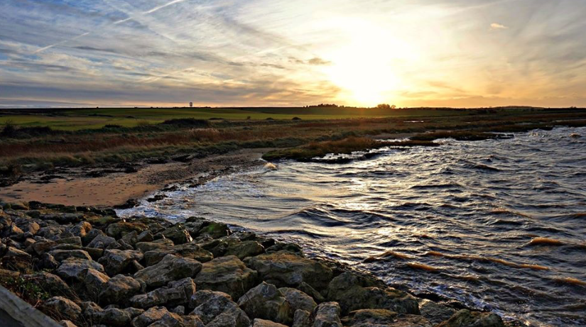
The Hoo Peninsula is home to the Thames and Medway Estuary Marshes covering an area of 38 sq miles from Gravesend rounding the Isle of Grain to Rochester. It is the central most important and fundamental feature of the greater North Kent Marshes which stretches from Dartford all the way to Whitstable.
The Hoo Peninsula is the custodian of a Ramsar, Sites of Special Scientific Interest (SSSI) and Special Protected Areas (SPA). They include coastal grazing marsh, intertidal mudflats, salt marsh and fresh water lagoons. At the end of the escarpment of the North Downs lies Northwood Hill, a National Nature Reserve, overlooking the marsh to the north.
Picture if you will the dikes fanning out across marsh to the estuary beyond channelling the gently ebbing and flowing tide. Look a little closer and see the myriad of wildlife feeding on the richly fertile mudflat with its high content of organic material ideal for the filter feeding scavenger Invertebrates and of course flocks of wintering wildfowl, phenomenal and spectacular in numbers.
In the foreground the vast expanse of lowland wet grassland lies in front of the sea wall maintaining a bio diverse food source when the salt marsh is covered by the tide. True Dickens Country!
Unlocking the potential of the Hoo Peninsula to development will herald the beginning of the end for this national treasure for ever and the unstoppable march of the urban fringe.
Please join with me and help make the Hoo Peninsula a National Park.
Help Protect our Natural and Cultural Heritage.
Help to make it a place where people and nature are better connected.
A place that continues to be rich in wildlife.
A place where we, our children and our grandchildren, can connect with nature and benefit from exploring, playing and learning.
We are among the most Nature depleted nations in the world our government statisticians tell us that :-
We have lost 97% of our wildflower meadows since 1930.
We have ever more specie of birds in decline.
Insects and invertebrates are struggling.
A third of our British bees are in decline.
WE MUST START NOW to make a change by embracing the idea of a National Park for the Hoo Peninsula, perhaps even encompassing the whole of the North Kent Marshes. Making the whole area as large as the North Norfolk Coast.
We have the landscape, the raw beauty, the geology, the geography, the biodiversity, the history, the archaeology and the rare species of plants and animals.
What we now need is the will to start to plan and to work together with a real ambition to achieve a healthier, happier future and ensure our wonderful countryside is greener, more beautiful and PROTECTED FOR THE WHOLE NATION.
Please visit my website and pledge your support for the Hoo Peninsula National Park.
The Peninsula should be designated a National Park
We all aware that the Medway Local plan, originally due to be updated in 2003 is still not published. In its present draft form it relies on a £170 million grant, not yet approved by central government to make sufficient improvements to our infrastructure for any large-scale sustainable development. In the meantime predatory unrestricted development is extending the urban fringe ever further on to the Peninsula.
I believe the Hoo Peninsula as a whole has sufficient merit to be declared a national park. The last National Park designated in the UK 2010 was the South Downs. A national park shares two statutory purposes:-
To conserve and enhance the natural and cultural heritage of the area, To promote the understanding and enjoyment of the special qualities of the area.
The special qualities of a National Park include their Landscape and views Geology and geography Biodiversity and rare species Archaeology and history
I believe that our Peninsula meets all these criteria. Becoming a National Park would afford protection against unsustainable development and would enhance and celebrate it for what it is, a unique area full of natural and cultural heritage.
.
We fought long and hard to protect the peninsula from becoming the site of an international hub airport. The nation is in equal danger in of losing it again to the ever-growing urban sprawl.
Please lead your support and join with us to protect our Peninsula, an area of environmental, historical, national and international importance.
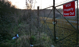
At one time Lodge Hill was just like every other “Brown Field” site in the country but the discovery of Nightingale has changed that forever.
As a nation, we have decided that those places that have been proven to be of national importance for wildlife should be protected. They are called Sites of Special Scientific Interest (nationally) and Special Protection Areas (internationally), and the rules that govern what can be built where say that, in layperson’s terms, these sites should not be destroyed or damaged. That damage isn’t only by them being built on, but the damage could come from building next to them – what are called ‘indirect effects’
The Hoo Peninsula is surrounded by protected wildlife sites – the Thames Estuary & Marshes, the Medway Estuary and Marshes, with Chattenden Woods and Lodge Hill in the middle.
Lodge Hill was protected because it holds the largest population of Nightingales in the whole of the UK. Nightingales are one of our most threatened species, having declined by 90% in the last 50 years, and with less than 5,500 pairs left.
The reason why Lodge Hill was such a big case nationally is in part because of the Nightingales but also because of the precedent it would set for protected sites everywhere
Homes England, the government’s ‘housing accelerator’, has now accepted that it would not be right to build on Lodge Hill, which was a major step
We are continuing to make the case that new housing shouldn’t be within 400m of Lodge Hill because of the indirect effects (lighting, noise, dogs, cats, people…etc etc – Nightingales can’t cope with all that)
If anyone was to say that they’d rather have Lodge Hill developed than Hoo St W, there is a very strong answer: If people start calling for protected sites to be built on, they risk getting the protected sites AND the non protected sites built on. They will have thrown away one of their key lines of defence.
Please note that this website is owned by George Crozer of Woodlands High Halstow Kent ME3 8SX telephone number 07711432598 and is being used to promote RON SANDS as an independent candidate in the Medway local elections to be held on 2nd May 2019.
I think Ron is an ideal Candidate to represent Hoo Peninsula Ward on Medway Council. He will certianly have my vote!
Medway currently has four Air Quality Management Areas which exceed the annual objective for nitrogen dioxide (a pollutant present in vehicle exhaust emissions).
We are now in 2019 and predatory development rampant at Chattenden, Hoo and High Halstow. There is a massive increase in warehousing at Kingsnorth with a reliance on heavy traffic all passing through Four Elms. The Council is now asking residents to help it to solve an air pollution problem the Council themselves have been complicit in creating.
In the meantime those of us that live in or pass through Four Elms continue to be exposed to exhaust emissions from vehicle traffic. The children of Chattenden and the children of the many new unsuspecting families moving into new homes close to Four Elms are being made to walk to school across this very dangerous major dual carriage way using the now two designated pedestrian crossings right at the epicentre of the air quality management area problem.
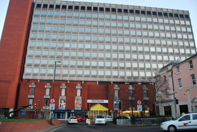
Mountbatten House has a floor area of approximately 84,000 square feet with 110 car parking spaces. Medway Council bought back the lease of the Pentagon, which includes Mountbatten House for 45 million pounds. They expect to get an annual income of one million pounds.
In 2016 Andrew Mackness had a vision for Mountbatten House to turn it into housing ( probably expensive apartments) with a hotel and rooftop bar which is probably the type of vanity project that the current council would like. Medway needs to start thinking of it’s current residents. This is the perfect opportunity to begin regenerating the centre of Chatham and to help solve it’s housing crisis. With the average 1 bedroom apartment being 495 square feet this building could have about 150 homes depending on corridor layouts. With government grants these could be managed social housing for local residents. Not only would the council get an income from rents and council tax but local businesses would benefit from more customers. There could also be more cultural activities in the Pentagon.
150 homes may not be a lot, but more developments like this in regenerated Chatham and Gillingham town centres, together with utilising existing empty properties, would make a significant contribution to Medway’s housing policy. There would be less need for car travel and it would also mean a lot less cars polluting the Hoo Peninsula.
In 2018 the government provided £8.5 million of resource support so Parishes can allocate land for homes sold or rented at a discount.
Has the time come for a discussion about Parish and Community led development Projects? Community lead affordable housing projects are intended to empower communities regardless of size to commission their own homes to meet local needs.
Rural housing is much more than just a roof over a family’s head and we all know how important that is. Making housing affordable is key for rural workforces and therefore important to the rural economy.
Homes identified under the scheme can be for purchase or rent.
My own personal choice would be rental ensuring homes would remain available indefinitely for those in most need from the local community.
Parish Councils and local communities have a major role to play in identifying suitable sites and agreeing the criteria for allocation of the resulting homes.
If elected by the people of the Peninsula within the first year of my office I would engage with Parish Councils, local social services and the English Rural Housing Association to carry out a housing needs survey and a call for sites.
Ignore low level crime and crooks will think they can GETAWAY with it.
Many residents on the Peninsula have been in touch in recent months to raise concerns about anti-social behaviour in our villages and the lack of police support to deal with it.
So called low level crime is not low level by those of us affected by it. All crime is unacceptable for residents and issues need to be addressed quickly so that members of our community feel safe and not intimidated or afraid to go out. Our rural communities should not be left to fend for themselves. Responses by police to emergency calls have been slow and currently we only have two Police Community Support Officers for the whole Peninsula. One of my first priorities if elected will be to call the police commissioner and our local MP to account and demand the policing team come up with a new robust strategy for policing on the Peninsula.
Whilst a lack of proper police funding from central government can be attributed to some of these problems Police still have the power to stop crime through prevention. I believe if you don’t take care of the low level crime happening every day criminals will think they can get away with much more..
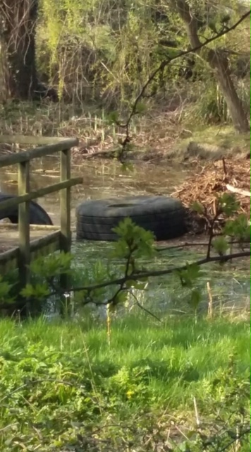
Update Last Friday I received a phone call from a very upset lady in Chattenden. She was devastated that developers working on the Old Arethusa site were filling in an ancient pond renowned for its Frogs and Toads that many of us enjoyed over the years and have taken our children to visit time after time.
Cllr Jean Fray and I met with the developers on site and managed to temporarily halt the filling. We are now having discussions with the developer and the planning dept.
I believe that the Ecological surveys being undertaken by developers are lacking and short cuts are common place. The statutory authority require all necessary ecological surveys to be complete before the granting of planning permission. However, some ecological surveys can only be undertaken at specific times of the year. This seasonality means that to be done properly the survey should be carried out over one complete season at the very least. This would ensure wildlife, flora and fauna are fully understood and the necessary protection applied .
I believe there is a case for Parish Councils having their own expert to carry out ecological inspections or a representative officer who can inform surveys of the local wildlife knowledge.
We have a duty to protect our environment and natural heritage for the benefit of future generations. So much has been lost already.
Research by scientists at WWF and the Zoological Society of London found that the number of wild animals on earth has halved in the past 40 years, according to a new analysis. Creatures across land, rivers and the seas are being decimated as humans kill them for food and development in unsustainable numbers, while polluting or destroying their habitats,
The steep decline of animal, fish and bird numbers was calculated by analysing 10,000 different populations, covering 3,000 species in total. This data was then, for the first time, used to create a representative “Living Planet Index” (LPI), reflecting the state of all 45,000 known vertebrates
.
This website uses cookies to improve your experience. We'll assume you're ok with this, but you can opt-out if you wish.AcceptRejectRead More
Privacy & Cookies Policy
Privacy Overview
This website uses cookies to improve your experience while you navigate through the website. Out of these, the cookies that are categorized as necessary are stored on your browser as they are essential for the working of basic functionalities of the website. We also use third-party cookies that help us analyze and understand how you use this website. These cookies will be stored in your browser only with your consent. You also have the option to opt-out of these cookies. But opting out of some of these cookies may affect your browsing experience.
Necessary cookies are absolutely essential for the website to function properly. This category only includes cookies that ensures basic functionalities and security features of the website. These cookies do not store any personal information.
Any cookies that may not be particularly necessary for the website to function and is used specifically to collect user personal data via analytics, ads, other embedded contents are termed as non-necessary cookies. It is mandatory to procure user consent prior to running these cookies on your website.

 My original thoughts on this has been widely supported by all Peninsula Parish Councils, Ward councillors Cllr. Filmer, Cllr. Pendergast , Medway Cllr Simon Curry and our MP Kelly Tolhurst (
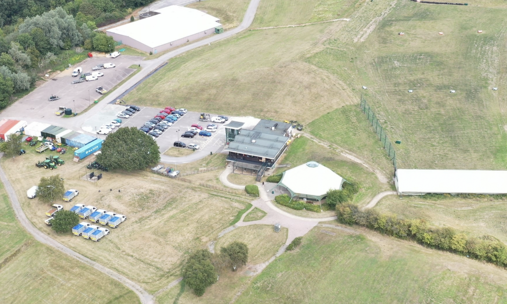


 predominantly a remote and tranquil landscape of shallow creeks, drowned estuaries, lowlying islands, mudflats and broad tracts of tidal salt marsh and reclaimed grazing marsh that lies between the North Sea and the rising ground inland. It forms the eastern edge of the London Basin and encompasses the coastlines of South Essex and North Kent, along with a narrow strip of land following the path of the Thames into East London.
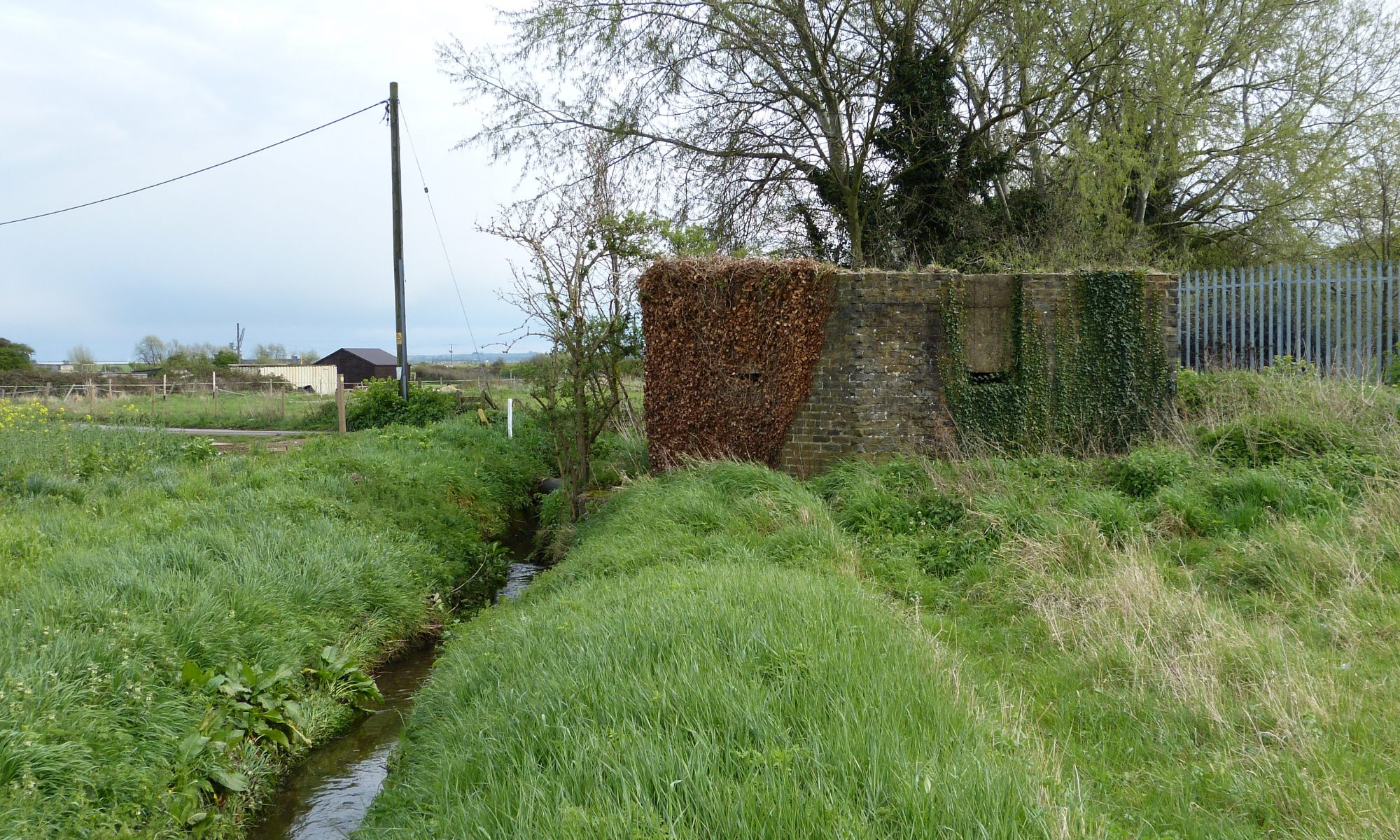
 During the Second World War, the Hoo Peninsula was one of the most heavily fortified areas anywhere in England. Defensive ‘